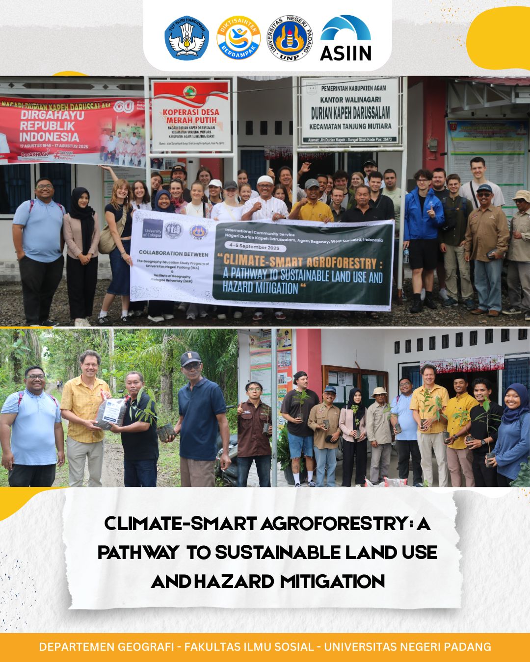
Agam Regency, Indonesia — October 2025
An international community service initiative titled “Climate-Smart Agroforestry: A Pathway to Sustainable Land Use and Hazard Mitigation” has been launched by the Geography Study Program, Faculty of Social Sciences, Universitas Negeri Padang (UNP). The program aims to empower local communities through the integration of smart agroforestry practices and geospatial technologies, with a focus on education, environmental resilience, and sustainable development.
Led by Dr. Febriandi, S.Pd., M.Si., the program brings together a multidisciplinary team of experts, students, and international partners. Team members include Dr. Helfia Edial, M.T., Dipo Caesario, ST., MT., and student contributors Avrilia Hanifah and Fahrul Rozi. International collaboration is strengthened by the involvement of Prof. Boris Braun and Ajeng Larasati from the University of Cologne, Germany, alongside local leadership from Adri, Wali .
Program Structure and Implementation
To achieve its objectives, the program follows a structured approach across three core activities:
- Identifying Community Needs and Objectives
Initial assessments are conducted to determine the training needs of teachers and students, particularly in preparation for national science competitions. These include understanding geography concepts, using digital applications, and developing competition strategies. - Training Planning and Socialization
A detailed training plan is developed based on the identified needs. This includes selecting appropriate materials, teaching methods, and scheduling, with active participation from community partners. - Continuous Monitoring and Evaluation
The program incorporates ongoing evaluation and feedback mechanisms to ensure effectiveness and adaptability. Community partners are involved in assessing the impact of teaching materials and contributing to national-level publications.
Empowering Through Science and Technology
The initiative leverages smart agroforestry—a data-driven approach combining ecological science and modern agriculture—to promote biodiversity, soil conservation, and climate resilience. Meanwhile, geospatial technologies such as GIS and satellite imagery enable precise land monitoring and hazard assessment, enhancing both academic and practical applications.
Team Expertise and Roles
Each team member plays a vital role in the program’s success:
- Dr. Febriandi specializes in geospatial applications and media design.
- Dr. Helfia Edial contributes expertise in spatial analysis and geographic education.
- Dipo Caesario focuses on instructional media and learning strategy development.
- Students assist in material preparation and data collection.
- International and local partners support evaluation and community engagement.
Sustainability and Long-Term Impact
The program emphasizes sustainability through continuous adaptation and capacity building. By equipping educators and students with practical skills, it fosters long-term knowledge retention and self-reliance. The integration of smart agroforestry and geospatial tools not only supports academic achievement but also contributes to environmental stewardship and hazard mitigation.
This initiative stands as a model for international collaboration in community development, demonstrating how science and education can drive meaningful change in the face of climate and environmental challenges.